Söğütlü
District and municipality in Sakarya, Turkey
40°54′N 30°29′E / 40.900°N 30.483°E / 40.900; 30.483 (2022)[1]
54160
Söğütlü is a municipality and district of Sakarya Province, Turkey.[2] Its area is 145 km2,[3] and its population is 14,724 (2022).[1] The mayor is Koray Oktay Özten (AKP).

Composition
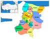
There are 23 neighbourhoods in Söğütlü District:[4]
- Akarca
- Akçakamış
- Akgöl
- Beşdeğirmen
- Camicedid
- Fındıklı
- Gündoğan
- Hasanfakı
- İmamlar
- Kantar
- Karateke
- Küçüksöğütlü
- Kurudil
- Levent
- Mağara
- Maksudiye
- Orta
- Rüstemler
- Sıraköy
- Soğucak
- Tokmaklıdere
- Türkbeylikkışla
- Yeniköy
References
- ^ a b "Address-based population registration system (ADNKS) results dated 31 December 2022, Favorite Reports" (XLS). TÜİK. Retrieved 19 September 2023.
- ^ Büyükşehir İlçe Belediyesi, Turkey Civil Administration Departments Inventory. Retrieved 19 September 2023.
- ^ "İl ve İlçe Yüz ölçümleri". General Directorate of Mapping. Retrieved 19 September 2023.
- ^ Mahalle, Turkey Civil Administration Departments Inventory. Retrieved 19 September 2023.
- v
- t
- e
Söğütlü in Sakarya Province of Turkey

| Istanbul | |
|---|---|
| West Marmara | |
| Aegean | |
| East Marmara | |
| West Anatolia | |
| Mediterranean | |
| Central Anatolia | |
| West Black Sea | |
| East Black Sea | |
| Northeast Anatolia | |
| Central East Anatolia | |
| Southeast Anatolia | |
Metropolitan municipalities are bolded.
| Authority control databases: National |
|
|---|
 | This geographical article about a location in Sakarya Province, Turkey is a stub. You can help Wikipedia by expanding it. |
- v
- t
- e


