La Limouzinière
Gemeente in Frankrijk  | |||
|---|---|---|---|
 | |||
  | |||
| Situering | |||
| Regio | Pays de la Loire | ||
| Departement | Loire-Atlantique (44) | ||
| Arrondissement | Nantes | ||
| Kanton | Saint-Philbert-de-Grand-Lieu | ||
| Coördinaten | 46° 59′ NB, 1° 36′ WL | ||
| Algemeen | |||
| Oppervlakte | 29,54 km² | ||
| Inwoners (1 januari 2021) | 2.477[1] (84 inw./km²) | ||
| Hoogte | 8 - 50 m | ||
| Overig | |||
| Postcode | 44310 | ||
| INSEE-code | 44083 | ||
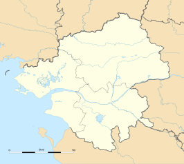
| Detailkaart | |||
 | |||
| Foto's | |||
 | |||
| Église Notre-Dame | |||
| |||

La Limouzinière is een gemeente in het Franse departement Loire-Atlantique in de regio Pays de la Loire. De plaats maakt deel uit van het arrondissement Nantes. La Limouzinière Legé telde op 1 januari 2021 2.477[1] inwoners.
Geografie
De oppervlakte van La Limouzinière bedroeg op 1 januari 2021 29,54 vierkante kilometer; de bevolkingsdichtheid was toen 83,9 inwoners per km².

Demografie
Onderstaande figuur toont het verloop van het inwonertal (bron: INSEE-tellingen).

Externe links
- (fr) Statistische informatie op de website van INSEE
Bronnen, noten en/of referenties
- ↑ a b Populations légales 2021.
Gemeenten in het kanton Saint-Philbert-de-Grand-Lieu
Le Bignon · La Chevrolière · Corcoué-sur-Logne · Geneston · Legé · La Limouzinière · Montbert · Pont-Saint-Martin · Saint-Colomban · Saint-Lumine-de-Coutais · Saint-Philbert-de-Grand-Lieu · Touvois
Mediabestanden
Zie de categorie La Limouzinière van Wikimedia Commons voor mediabestanden over dit onderwerp.


