Camps-Saint-Mathurin-Léobazel
Gemeente in Frankrijk  | |||
|---|---|---|---|
 | |||
  | |||
| Situering | |||
| Regio | Nouvelle-Aquitaine | ||
| Departement | Corrèze (19) | ||
| Arrondissement | Tulle | ||
| Kanton | Argentat-sur-Dordogne | ||
| Coördinaten | 44° 59' NB, 1° 59' OL | ||
| Algemeen | |||
| Oppervlakte | 34,08 km² | ||
| Inwoners (1 januari 2021) | 210[1] (6 inw./km²) | ||
| Hoogte | 160 - 623 m | ||
| Overig | |||
| INSEE-code | 19034 | ||
| |||

Camps-Saint-Mathurin-Léobazel is een gemeente in het Franse departement Corrèze (regio Nouvelle-Aquitaine) en telt 243 inwoners (2005). De plaats maakt deel uit van het arrondissement Tulle.
Geografie
De oppervlakte van Camps-Saint-Mathurin-Léobazel bedraagt 32,6 km², de bevolkingsdichtheid is 7,5 inwoners per km².
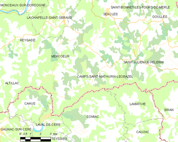
De onderstaande kaart toont de ligging van Camps-Saint-Mathurin-Léobazel met de belangrijkste infrastructuur en aangrenzende gemeenten.
 |
Demografie
Onderstaande figuur toont het verloop van het inwonertal (bron: INSEE-tellingen).

Externe links
- Informatie over Camps-Saint-Mathurin-Léobazel
- (fr) Statistische informatie op de website van INSEE
Mediabestanden
Zie de categorie Camps-Saint-Mathurin-Léobazel van Wikimedia Commons voor mediabestanden over dit onderwerp.
- ↑ Populations légales 2021.


