Wutha-Farnroda
Municipality in Thuringia, Germany

Coat of arms
Location of Wutha-Farnroda within Wartburgkreis district

(2020–26) Jörg Schlothauer[1]
(2022-12-31)[2]
99848
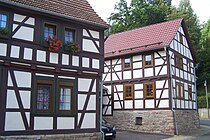
Wutha-Farnroda is a municipality in the Wartburgkreis district of Thuringia, Germany.
Wutha station is located on the Halle–Bebra railway.
Population development
- 1994: 8.770
- 2000: 7.794
- 2004: 7.405
- 2010: 6.560
- 2014: 6.360
References
- ^ Gewählte Bürgermeister - aktuelle Landesübersicht, Freistaat Thüringen, accessed 14 July 2021.
- ^ "Bevölkerung der Gemeinden, erfüllenden Gemeinden und Verwaltungsgemeinschaften in Thüringen Gebietsstand: 31.12.2022" (in German). Thüringer Landesamt für Statistik. June 2023.
External links
 Media related to Wutha-Farnroda at Wikimedia Commons
- v
- t
- e
Towns and municipalities in Wartburgkreis
- Amt Creuzburg
- Bad Liebenstein
- Bad Salzungen
- Barchfeld-Immelborn
- Berka vor dem Hainich
- Bischofroda
- Buttlar
- Dermbach
- Eisenach
- Empfertshausen
- Geisa
- Gerstengrund
- Gerstungen
- Hörselberg-Hainich
- Kaltennordheim
- Krauthausen
- Krayenberggemeinde
- Lauterbach
- Leimbach
- Nazza
- Oechsen
- Ruhla
- Schleid
- Seebach
- Treffurt
- Unterbreizbach
- Vacha
- Weilar
- Werra-Suhl-Tal
- Wiesenthal
- Wutha-Farnroda

Authority control databases | |
|---|---|
| International |
|
| National |
|
| Geographic |
|
 | This Wartburgkreis location article is a stub. You can help Wikipedia by expanding it. |
- v
- t
- e


