Tonzang Township
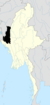
Tonzang Township in Chin State, Myanmar
Tonzang Township တွန်းဇံမြို့နယ် | |
|---|---|
Tonzang Township (Red) | |
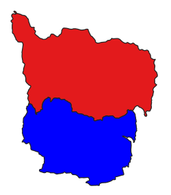 Location in Tedim District | |
| Coordinates: 23°45′N 93°44′E / 23.750°N 93.733°E / 23.750; 93.733 | |
| Country |  Myanmar Myanmar |
| State | Chin State |
| District | Tedim District |
| Township | Tonzang Township |
| Administrative centre | Tonzang |
| Area | |
| • Total | 1,340.25 sq mi (3,471.24 km2) |
| Population (2014) | 31,878 |
| Time zone | UTC+6:30 (MST) |
Tonzang Township (Burmese: တွန်းဇံမြို့နယ်) is a township in Tedim District, Chin State of Myanmar.[1] The 3,471.24-square-kilometre Tonzang Township is bordered by Tedim Township in the south, Kale Township of the Sagaing Division in the south-east, Tamu Township of the Sagaing Division in the north-east, the Indian state of Manipur in the north and the Indian state of Mizoram in the west.
Administrative divisions
The capital city of Tonzang Township is Tonzang. Tonzang Township is divided in 32 regions called villages:
- Anlun
- Balbil
- Bapi
- Buangmual
- Darkhai (A)
- Gelmual
- Haicin
- Haipi
- Hangken
- Kampum
- Kansau
- Khuabem
- Lamthang
- Linhnuat
- Lungtak
- Mualpi
- Nakzang
- Pangmual
- Phaitu
- Saipimual
- Salzang
- Sebawk
- Senam
- Singpial
- Sipek
- Suangpek
- Suangzang
- Thuitum
- Tongcin
- Tonzang (Urban)
- Tuimang
- Tuimui
- Tungtuang
- Zampi
Notes
- ^ Township 63 "Myanmar States/Divisions & Townships Overview Map" map ID: MIMU001, created: December 2007, Myanmar Information Management Unit (MIMU)
External links
- "Tonzang Township, Chin State"[permanent dead link] map ID: MIMU249v1, created 6 August 2009, Myanmar Information Management Unit (MIMU)
- "Tonzang Google Satellite Map" Maplandia World Gazetteer
- v
- t
- e
Capital: Hakha
- Tedim Township
- Tonzang Township

 | This Chin State location article is a stub. You can help Wikipedia by expanding it. |
- v
- t
- e


