Seeb
Province in Muscat, Oman
Seeb As-Sīb (ٱلسِّيْب) | |
|---|---|
Province | |
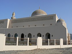 A mosque in As-Seeb | |
23°40′49″N 58°10′57″E / 23.68028°N 58.18250°E / 23.68028; 58.18250 | |
| Country |  Oman Oman |
| Region | Muscat |
| Population (2020)[1] | |
| • Total | 470,878 |
| Time zone | UTC+4 (+4) |
Al-Seeb, As Seeb or As Sib (Arabic: ٱلسِّيْب, romanized: As-Sīb) is a coastal fishing province, located several kilometres northwest of Muscat, in northeastern Oman. At the 2020 census, it had a population of 470,878.[1]
Landmarks include the Naseem Garden, the Royal Stables and Equestrian Centre, Royal Guard of Oman Technical College, Al Baraka Palace, Muscat International Airport and Markaz al Bahja.[2]
History
The "Fort of Sibo" was located here. It complemented the defence of Muscat Square, which was one of its first and most important roles.[3] It was part of a series of fortified cities that the Portuguese put up to control access to the Persian Gulf and the Gulf of Oman, like Khor Fakan, Muscat, Sohar, Seeb, Qurayyat and Muttrah. It has been demolished, at its former location today stands the Muscat International Airport. As-Seeb is known for being the venue in which the Treaty of Seeb agreement took place between the Imamate of Oman and the Sultanate of Muscat on 25 September 1920. This treaty divided Oman into two distinct regions, the hinterland and the coast, which were separated historically by the Hajar Mountains.[4][5]
-
![Portuguese Fortress of Seeb (Sibo). Livro das plantas de todas as fortalezas, cidades e povoaçoens do Estado da India Oriental / António Bocarro [1635].](//upload.wikimedia.org/wikipedia/commons/thumb/f/f8/Sibo_SEEB_Oman.jpg/120px-Sibo_SEEB_Oman.jpg) Portuguese Fortress of Seeb (Sibo). Livro das plantas de todas as fortalezas, cidades e povoaçoens do Estado da India Oriental / António Bocarro [1635].
Portuguese Fortress of Seeb (Sibo). Livro das plantas de todas as fortalezas, cidades e povoaçoens do Estado da India Oriental / António Bocarro [1635]. -
 Main cities, ports and routes of the Portuguese empire in the Persian Gulf in the 16th and 17th centuries
![Portuguese Fortress of Seeb (Sibo). Livro das plantas de todas as fortalezas, cidades e povoaçoens do Estado da India Oriental / António Bocarro [1635].](http://upload.wikimedia.org/wikipedia/commons/thumb/f/f8/Sibo_SEEB_Oman.jpg/120px-Sibo_SEEB_Oman.jpg)

Regions
The province has many different district that are diverse in culture and nature, these include Al Khoudh, where Sultan Qaboos University is located, Al-Mabellah, Al-Hail, Ar-Rusail, Muscat Hills, and Wadi Lawami.[citation needed]
Intelligence gathering
In June 2014 The Register disclosed that Seeb is the location of a "beyond top secret" GCHQ internet monitoring site.[6]
Sports
Al-Seeb Club and Al-Shabab are located in Seeb.[citation needed]
Wadi Al-Khoudh
Wadi Al-Khoudh is a Valley in Seeb which is a major tourist attraction for locals and foreigners, and it is located near Old Al-Khoudh Village in the state, The valley is most popular for off-road adventurers. The valley has a beautiful mixture of mesmerizing sights varying from clear water pools, green outcrops, and rock formations and is recommended for a picnic.[7]
Sultan Haitham City
In May 2023, Sultan Haitham bin Tariq inaugurated the new Sultan Haitham City that will be built on an area of approximately fifteen million square meters of undeveloped land in Seeb. The intention for the new city is to house 100,000 residents from Muscat's growing population.[8] There will be nearly three million square meters of green spaces including a central park. The city will be organized into nineteen walkable neighborhoods with thirty-nine schools, eleven health facilities, and a university.[9] Construction began in February 2024 and phase one is expected to be completed by 2030.[10]
Climate
Seeb has a hot desert climate (Köppen climate classification BWh) with very hot summers and warm winters. Precipitation is low, and falls mainly in the months from December to April.[11]
| Climate data for Seeb | |||||||||||||
|---|---|---|---|---|---|---|---|---|---|---|---|---|---|
| Month | Jan | Feb | Mar | Apr | May | Jun | Jul | Aug | Sep | Oct | Nov | Dec | Year |
| Record high °C (°F) | 34.2 (93.6) | 37.0 (98.6) | 41.4 (106.5) | 44.0 (111.2) | 47.0 (116.6) | 48.3 (118.9) | 49.2 (120.6) | 46.8 (116.2) | 43.6 (110.5) | 42.0 (107.6) | 37.8 (100.0) | 33.0 (91.4) | 49.2 (120.6) |
| Mean daily maximum °C (°F) | 25.5 (77.9) | 26.1 (79.0) | 29.8 (85.6) | 34.7 (94.5) | 39.5 (103.1) | 40.4 (104.7) | 38.6 (101.5) | 36.2 (97.2) | 36.3 (97.3) | 35.0 (95.0) | 30.5 (86.9) | 27.1 (80.8) | 33.3 (92.0) |
| Daily mean °C (°F) | 21.3 (70.3) | 21.9 (71.4) | 25.2 (77.4) | 29.8 (85.6) | 34.2 (93.6) | 35.2 (95.4) | 34.3 (93.7) | 32.0 (89.6) | 31.4 (88.5) | 29.7 (85.5) | 25.7 (78.3) | 22.6 (72.7) | 28.6 (83.5) |
| Mean daily minimum °C (°F) | 17.3 (63.1) | 17.6 (63.7) | 20.7 (69.3) | 24.7 (76.5) | 29.1 (84.4) | 30.6 (87.1) | 30.4 (86.7) | 28.4 (83.1) | 27.5 (81.5) | 24.9 (76.8) | 20.9 (69.6) | 18.5 (65.3) | 24.2 (75.6) |
| Record low °C (°F) | 11.5 (52.7) | 12.5 (54.5) | 14.4 (57.9) | 17.5 (63.5) | 19.6 (67.3) | 24.5 (76.1) | 25.0 (77.0) | 23.3 (73.9) | 23.0 (73.4) | 17.5 (63.5) | 14.3 (57.7) | 14.4 (57.9) | 11.5 (52.7) |
| Average precipitation mm (inches) | 12.8 (0.50) | 24.5 (0.96) | 15.9 (0.63) | 17.1 (0.67) | 7.0 (0.28) | 0.9 (0.04) | 0.2 (0.01) | 0.8 (0.03) | 0.0 (0.0) | 1.0 (0.04) | 6.8 (0.27) | 13.3 (0.52) | 100.3 (3.95) |
| Average relative humidity (%) | 63 | 64 | 58 | 45 | 42 | 49 | 60 | 67 | 63 | 55 | 60 | 65 | 58 |
| Mean monthly sunshine hours | 268.6 | 244.8 | 278.3 | 292.5 | 347.4 | 325.7 | 277.7 | 278.6 | 303.9 | 316.9 | 291.9 | 267.0 | 3,493.3 |
| Source: NOAA (1979–1990)[11] | |||||||||||||
References
- ^ a b "Oman: Governorates, Major Cities & Villages". CityPopulation.de. Retrieved 26 April 2013.
- ^ Darke, Diana; Shields, Sandra (1 December 2006). Oman: The Bradt Travel Guide. Bradt Travel Guides. p. 113. ISBN 978-1-84162-168-5. Retrieved 27 February 2011.
- ^ "Fortalezas.org".
- ^ Dr Francis Owtram. "A Close Relationship: Britain and Oman Since 1750". QDL.
- ^ "BBC Middle East: Oman profile - Timeline (25 April 2018)". BBC News.
- ^ Duncan Campbell (3 June 2014). "Revealed: GCHQ's beyond top secret middle eastern internet spy base". The Register.
- ^ "Wadi Al Khoudh – OmanTripper". Retrieved 2022-10-02.
- ^ "HM presides over inauguration of "Sultan Haitham City" at Al Baraka Palace". Times of Oman. 31 May 2023. Retrieved 20 April 2024.
- ^ "Muscat: His Majesty launches Sultan Haitham City". Oman Daily Observer. 31 May 2023. Retrieved 20 April 2024.
- ^ "Construction begins at Sultan Haitham City". Muscat Daily. 4 February 2024. Retrieved 20 April 2024.
- ^ a b "Seeb Climate Normals 1979-1990". National Oceanic and Atmospheric Administration. Retrieved January 15, 2013.
External links
- v
- t
- e

Capital: Muscat
- Abu Nukhayl
- Ad Duwaykah
- Al Amarat
- Al Bustan
- Al Jafnayn
- Al Khawd
- Ash Shutayfi
- Bandar Jissah
- Bandar Khayran
- Bawshar
- Bayt al Falaj
- Bin `Umran
- Falaj
- Falaj ash Sham
- Fath al Bu Sa`id
- Ghallah
- Ghubrah
- Ghursheba
- Halban
- Hamriyah
- Haramil
- Hayl al `Umayr
- Jal
- Jifar
- Kalbuh
- Lansab
- Ma`abilah
- Manumah
- Muscat
- Matrah
- Mawalih
- Mu`skar al Murtafi`ah
- Qantab
- Riyam
- Rusayl
- Ruwi
- Sad
- Saruq
- Sayh al Malih
- Seeb
- Sidab
- Suraj
- Tawiyan
- Tawiyan Yiti
- Taww
- Wadi Kabir
- Wutayyah
- Yenkit
- Yiti
| ||||||||||||||||||||||||||||||||||||||||||||||||||||||||||||||||||||||||
|---|---|---|---|---|---|---|---|---|---|---|---|---|---|---|---|---|---|---|---|---|---|---|---|---|---|---|---|---|---|---|---|---|---|---|---|---|---|---|---|---|---|---|---|---|---|---|---|---|---|---|---|---|---|---|---|---|---|---|---|---|---|---|---|---|---|---|---|---|---|---|---|---|
|  | |||||||||||||||||||||||||||||||||||||||||||||||||||||||||||||||||||||||
|
| ||||||||||||||||||||||||||||||||||||||||||||||||||||||||||||||||||||||||
| ||||||||||||||||||||||||||||||||||||||||||||||||||||||||||||||||||||||||
| ||||||||||||||||||||||||||||||||||||||||||||||||||||||||||||||||||||||||
| ||||||||||||||||||||||||||||||||||||||||||||||||||||||||||||||||||||||||
| ||||||||||||||||||||||||||||||||||||||||||||||||||||||||||||||||||||||||
Authority control databases | |
|---|---|
| International |
|
| National |
|


