Campo Belo
You can help expand this article with text translated from the corresponding article in Portuguese. (April 2013) Click [show] for important translation instructions.
- View a machine-translated version of the Portuguese article.
- Machine translation, like DeepL or Google Translate, is a useful starting point for translations, but translators must revise errors as necessary and confirm that the translation is accurate, rather than simply copy-pasting machine-translated text into the English Wikipedia.
- Consider adding a topic to this template: there are already 1,522 articles in the main category, and specifying
|topic=will aid in categorization. - Do not translate text that appears unreliable or low-quality. If possible, verify the text with references provided in the foreign-language article.
- You must provide copyright attribution in the edit summary accompanying your translation by providing an interlanguage link to the source of your translation. A model attribution edit summary is
Content in this edit is translated from the existing Portuguese Wikipedia article at [[:pt:Campo Belo]]; see its history for attribution. - You may also add the template
{{Translated|pt|Campo Belo}}to the talk page. - For more guidance, see Wikipedia:Translation.
Place in Southeast, Brazil

Flag

Seal
Portuguese: União, Ordem e Progresso (Union, Order and Progress)
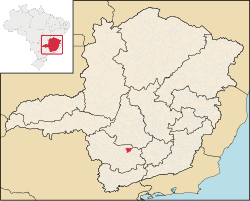
Location in Brazil
 Brazil
 (2020 [1])
Campo Belo (Portuguese for "beautiful field") is a city located in Minas Gerais state, in Brazil. The estimated population in 2020 was 54,186 inhabitants, and the total area of the municipality was 528.225 square kilometres (203.949 sq mi). It was founded in 1879.
Geography
Climate
Campo Belo's climate can be classified as tropical altitude, with yearly average temperature of 23.5 °C (74.3 °F). The Köppen climate classification of the region is Cwa (Tropical on high altitudes, humid/warm summer and a dry/cool winter).
| Campo Belo | ||||||||||||||||||||||||||||||||||||||||||||||||||||||||||||
|---|---|---|---|---|---|---|---|---|---|---|---|---|---|---|---|---|---|---|---|---|---|---|---|---|---|---|---|---|---|---|---|---|---|---|---|---|---|---|---|---|---|---|---|---|---|---|---|---|---|---|---|---|---|---|---|---|---|---|---|---|
| Climate chart (explanation) | ||||||||||||||||||||||||||||||||||||||||||||||||||||||||||||
| ||||||||||||||||||||||||||||||||||||||||||||||||||||||||||||
| ||||||||||||||||||||||||||||||||||||||||||||||||||||||||||||
Soil
- Silic - Clay.
Topography
- Plain : 15%
- Waivy : 55%
- Mountain: 30%
References
- ^ IBGE 2020
- ^ "IBGE - Cidades@". O Brasil Município por Município. Brazilian Institute of Geography and Statistics (IBGE). Retrieved 2015-05-27.
- ^ "Ranking decrescente do IDH-M dos municípios do Brasil" [Ranking of HDI-M of Brazilian Municipalities] (PDF) (in Portuguese). United Nations Development Programme (UNDP). 2010. Retrieved 2013-08-03.
Wikimedia Commons has media related to Campo Belo.
- v
- t
- e

Capital: Belo Horizonte
| |||||||

| |||||||||||||
| |||||||||
| |||||||
| |||||||||||||||||||||
| |||||||||||||||
| |||||||
| |||||||||||
| |||||||||||||||
| |||||||||
| |||||||
| |||||||||||||||||||||
Authority control databases | |
|---|---|
| International |
|
| National |
|


